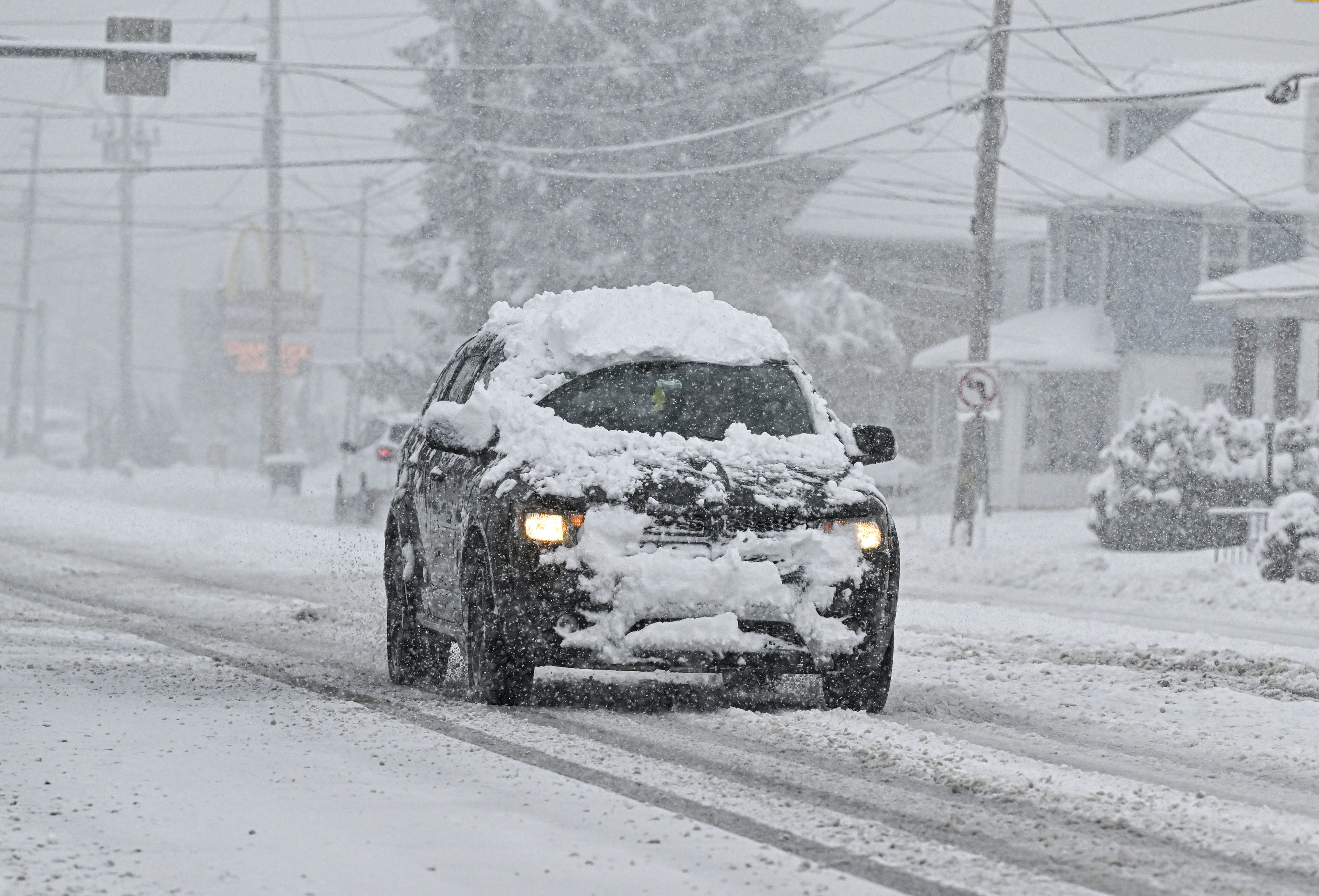
Vehicles travel slowly along Easton Ave. through a snowstorm Tuesday, Feb. 13, 2024, in Bethlehem.
More snow is expected in the Lehigh Valley late Friday night into Saturday, and accumulations could be a little higher than forecasters initially expected.
An updated winter weather advisory for the region, which goes into effect 10 p.m. Friday, is calling for 2 to 4 inches of snow across the region, with locally higher amounts up to 5 inches.
In the snowfall projection map issued Friday afternoon by the National Weather Service’s Mount Holly, N.J., forecast office, southern portions of the Lehigh Valley were in the area forecasted to receive at least 4 inches. The rest of the Lehigh Valley and Poconos was in the area expected to receive between 3 and 4 inches.
Snowfall amounts are expected to be even higher south of the Lehigh Valley. A winter storm warning is now in effect for southern portions of Montgomery and Bucks counties, as well as Delaware County, Chester County and Philadelphia.
Those areas could see up to 6 inches, according to the warning.
There is a possibility that snow could briefly become heavy during the overnight hours. Where those heavy bands of snow set up will have an impact on accumulations, according to the weather service forecast discussion.
The weather service said snow will likely come to the area about 10 p.m. and will stop between 7 a.m. and 10 p.m. Weather officials encourage those who have to travel overnight to use “extreme caution” or delay travel until after the snow stops.
Snowfall rates could reach a half an inch or an inch per hour at times, the weather service said.
A clipper system jogging across the country is producing the latest round of snow, with help from cold air that has moved into the region after a cold front passed through overnight, according to the weather service’s forecast discussion.
“One good thing with this system is that the low is fairly weak, so winds look pretty light as the system moves through,” the forecast discussion notes.
Although most of the snow will wrap up by mid-morning Saturday, additional snow showers could linger, according to the forecast discussion.
The rest of Saturday should be cloudy, with highs in the upper 30s.
The snow Friday comes days after the biggest snowstorm of the season, which brought up to a foot of snow to some areas of the Lehigh Valley Tuesday. The Lehigh Valley International Airport recorded 9.1 inches of snow from that storm alone.
Outside of Saturday, there is no snow in the immediate forecast. The weather service said another storm is possible next Friday, but it likely will be rain.
Temperatures are expected to reach the upper 40s next week. Here is the latest forecast from the National Weather Service:
Friday Night: Snow, mainly after 7 p.m. The snow could be heavy at times. Low around 27. West wind around 5 mph becoming calm in the evening. Chance of precipitation is 90%. Total nighttime snow accumulation of 2 to 4 inches possible.
Saturday: Snow likely before 10 a.m., then a chance of snow showers between 10 a.m. and 3 p.m. The snow could be heavy at times. Cloudy, then gradually becoming mostly sunny, with a high near 37. North wind 5 to 10 mph becoming west 10 to 15 mph in the afternoon. Chance of precipitation is 60%. New snow accumulation of less than one inch possible.
Saturday Night: Mostly clear, with a low around 18. Southwest wind 5 to 10 mph.
Sunday: Mostly sunny, with a high near 38. Breezy, with a southwest wind 10 to 15 mph increasing to 15 to 20 mph in the afternoon. Winds could gust as high as 30 mph.
Sunday Night: Mostly clear, with a low around 24. Southwest wind 5 to 10 mph.
Monday: Sunny, with a high near 41.
Monday Night: Partly cloudy, with a low around 22.
Tuesday: Mostly sunny, with a high near 44.
Tuesday Night: Mostly cloudy, with a low around 25.
Wednesday: Partly sunny, with a high near 47.
Wednesday Night: Mostly cloudy, with a low around 32.
Thursday: A chance of showers. Mostly cloudy, with a high near 48. Chance of precipitation is 30%.
How much snow fell in the Lehigh Valley? Totals from around the region [Update]
©2024 The Morning Call. Visit mcall.com. Distributed by Tribune Content Agency, LLC.
News Related-
Russian court extends detention of Wall Street Journal reporter Gershkovich until end of January
-
Russian court extends detention of Wall Street Journal reporter Evan Gershkovich, arrested on espionage charges
-
Israel's economy recovered from previous wars with Hamas, but this one might go longer, hit harder
-
Stock market today: Asian shares mixed ahead of US consumer confidence and price data
-
EXCLUSIVE: ‘Sister Wives' star Christine Brown says her kids' happy marriages inspired her leave Kody Brown
-
NBA fans roast Clippers for losing to Nuggets without Jokic, Murray, Gordon
-
Panthers-Senators brawl ends in 10-minute penalty for all players on ice
-
CNBC Daily Open: Is record Black Friday sales spike a false dawn?
-
Freed Israeli hostage describes deteriorating conditions while being held by Hamas
-
High stakes and glitz mark the vote in Paris for the 2030 World Expo host
-
Biden’s unworkable nursing rule will harm seniors
-
Jalen Hurts: We did what we needed to do when it mattered the most
-
LeBron James takes NBA all-time minutes lead in career-worst loss
-
Vikings' Kevin O'Connell to evaluate Josh Dobbs, path forward at QB